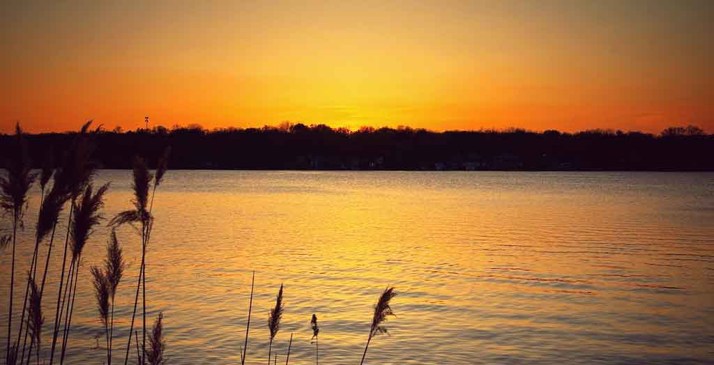
As you may have noticed, over the past few years, Wonder Lake has experienced a large increase in the population of Double-Crested Cormorants. The presence of these birds in large numbers is believed to have an impact on fish populations. Equally as important is that Cormorants prefer to roost and build nests on islands. Over time, the “droppings” from the roosting Cormorants can build up to the point where they can kill off the trees they roost in.
As part of the on-going efforts to complete the final design of the lake restoration project for Wonder Lake, the Wonder Lake MPOA has contracted with the U.S. Geological Survey to conduct an "EcoMapper" survey of the lake.
In Fall 2012, the Wonder Lake Master Property Owners Association (MPOA) completed an important element of our overall lake restoration project. This work included the placement of supplemental limestone rip-rap on the upstream face of the Wonder Lake dam embankment, and the installation of rip-rap “collars” around three island areas in the southeast quadrant of the lake.
BLUE GREEN ALAGAE (CYANOBACTERIA) AND MICROCYSTIN TOXIN
Q: What are blue green algae (cyanobacteria)?
The Hackmatack National Wildlife Refuge is a newly established United States national wildlife refuge that will include noncontiguous properties, especially tallgrass prairie patches, wetland properties, and oak savanna parcels, located in the northwestern region of the Chicago metropolitan area and the southern part of the Milwaukee area.
Dredging was completed in 2019. For pictures, information and description of the lake restoration.
 View Lake Restoration PDF for all information during the lake restoration process.
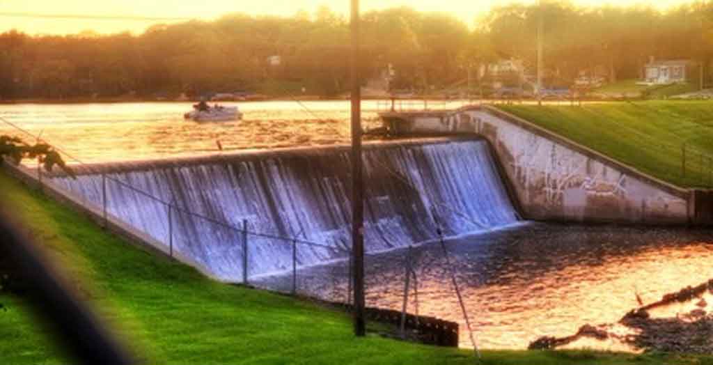
Wonder Lake was designed with a “run-of-the river” dam spillway, where all flow leaving the lake cascades over a concrete spillway with a fixed (non-adjustable) weir. This weir elevation is fixed at 803.0 feet above sea-level.
Subdivision and lakefront properties can experience a significant die-off of carp in the spring or early summer, which can occur on other area lakes as well.
On naturally formed lakes, native plant communities evolved, that created a continuum of vegetation, starting on the landward side with upland species and continuing downslope towards the lake where emergent, floating, and submergent wetland vegetation would be found.
Shoreline / streambank stabilization problems are usually caused by an excessive amount of wave or ice action, frequent water level fluctuations, or energy being diverted from adjacent streambank / shoreline areas with more robust stabilization practices in place. Landowners often have to take action to correct these problems.
The Wonder Lake Master Property Owners Association is reminding boaters, anglers, and water skiers to remove, drain, and dry after a day on the water to prevent the spread of invasive species. These Be a Hero—Transport Zero™ steps can now be found at 14 boat ramps around the Illinois private lake.
Everyone lives in a watershed whether you live close to a body of water or not. A watershed is the surrounding land that drains into a lake, stream, or river. It includes drainage systems such as ditches and storm sewers, which means you have a direct effect on water quality.
Each year the MPOA is required by the State of Illinois - Office of Water Resources to have an inspection of the Wonder Lake Dam embankment and spillway. This inspection is conducted by Professional Engineers retained by the MPOA, with state engineers also in attendance. The completed report is then forwarded to the Illinois Office of Water Resources.
It's crucial that we all take a moment to prioritize safety and respect for each other while enjoying the incredible resources of Wonder Lake. Whether you're a fisherman, pontoon boater, jet skier, or wake sports enthusiast, politeness and mutual respect ensure everyone enjoys their time on the water.
The McHenry County Department of Health has received numerous questions regarding the proper disposal of the fish carcasses when there is a natural die off of fish in Wonder Lake.